


Wikiloc Monreal

Peter.vdbergh
User GUIDE
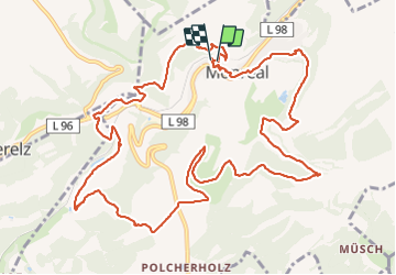

Length
13.8 km

Max alt
461 m

Uphill gradient
427 m
Km-Effort
19.5 km

Min alt
273 m

Downhill gradient
427 m
Boucle
Yes
Creation date :
2021-08-18 21:38:52.735
Updated on :
2021-08-18 21:45:02.226
3h56
Difficulty : Medium

FREE GPS app for hiking
 SityTrail
IGN / Geographical institutes
SityTrail Plus
The world is yours!
About
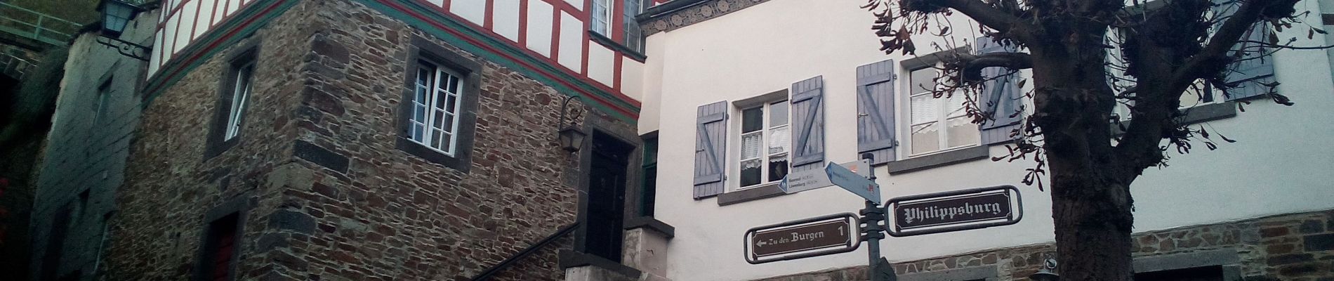
Trail Walking of 13.8 km to be discovered at Rhineland-Palatinate, Landkreis Mayen-Koblenz, Monreal. This trail is proposed by Peter.vdbergh.
Photos


25 photos in total. Please click on a photo to see them all in the gallery.
Positioning
Country:
Germany
Region :
Rhineland-Palatinate
Department/Province :
Landkreis Mayen-Koblenz
Municipality :
Monreal
Location:
Unknown
Start:(Dec)
Start:(UTM)
368868 ; 5573636 (32U) N.
Comments