


Peyrelevade, camping 🏕

Gegetop
User
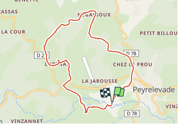

Length
9.8 km

Max alt
811 m

Uphill gradient
155 m
Km-Effort
11.9 km

Min alt
754 m

Downhill gradient
155 m
Boucle
Yes
Creation date :
2021-08-19 09:03:54.223
Updated on :
2021-08-19 12:13:17.063
2h35
Difficulty : Easy

FREE GPS app for hiking
 SityTrail
IGN / Geographical institutes
SityTrail Plus
The world is yours!
About
Trail Walking of 9.8 km to be discovered at New Aquitaine, Corrèze, Peyrelevade. This trail is proposed by Gegetop.
Description
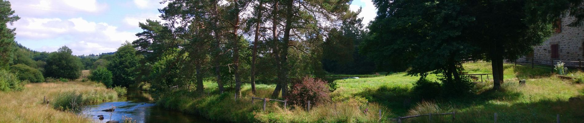
Petite boucle très facile autour du village en passant par la tourbière de la Vienne.
Photos


Positioning
Country:
France
Region :
New Aquitaine
Department/Province :
Corrèze
Municipality :
Peyrelevade
Location:
Unknown
Start:(Dec)
Start:(UTM)
425307 ; 5061220 (31T) N.
Comments