


Patigons-cabane sous Croix de l'Alpe

janussity
User
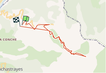

Length
10 km

Max alt
2200 m

Uphill gradient
760 m
Km-Effort
20 km

Min alt
1452 m

Downhill gradient
761 m
Boucle
Yes
Creation date :
2021-08-22 08:19:52.628
Updated on :
2021-08-22 15:03:30.686
1h21
Difficulty : Difficult

FREE GPS app for hiking
 SityTrail
IGN / Geographical institutes
SityTrail Plus
The world is yours!
About
Trail Walking of 10 km to be discovered at Provence-Alpes-Côte d'Azur, Alpes-de-Haute-Provence, Enchastrayes. This trail is proposed by janussity.
Description
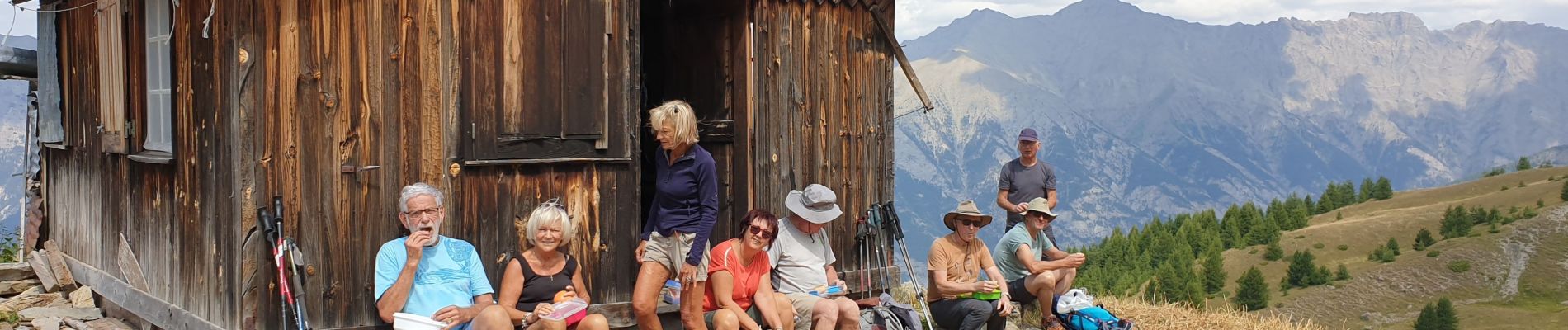
Circuit découverte vers la Croix de l'Alpe imaginé par Jean
Photos


Positioning
Country:
France
Region :
Provence-Alpes-Côte d'Azur
Department/Province :
Alpes-de-Haute-Provence
Municipality :
Enchastrayes
Location:
Unknown
Start:(Dec)
Start:(UTM)
317049 ; 4917248 (32T) N.
Comments