


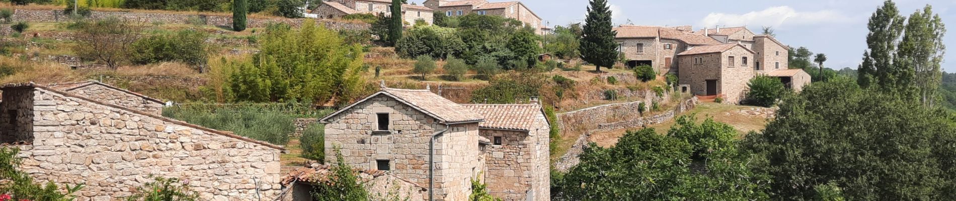
Faugères 13km

thonyc
User GUIDE
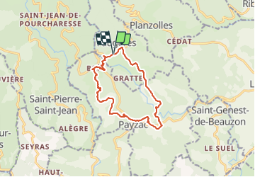

Length
12.9 km

Max alt
460 m

Uphill gradient
397 m
Km-Effort
18.2 km

Min alt
299 m

Downhill gradient
395 m
Boucle
Yes
Creation date :
2021-08-22 07:27:35.338
Updated on :
2021-08-22 22:17:35.645
4h53
Difficulty : Medium

FREE GPS app for hiking
 SityTrail
IGN / Geographical institutes
SityTrail Plus
The world is yours!
About
Trail Walking of 12.9 km to be discovered at Auvergne-Rhône-Alpes, Ardèche, Faugères. This trail is proposed by thonyc.
Photos


Positioning
Country:
France
Region :
Auvergne-Rhône-Alpes
Department/Province :
Ardèche
Municipality :
Faugères
Location:
Unknown
Start:(Dec)
Start:(UTM)
590329 ; 4925305 (31T) N.
Comments