


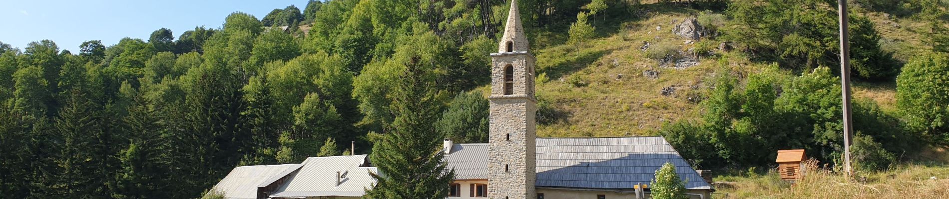
Eaux Tortes Laverq

janussity
User
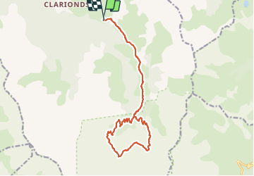

Length
18.8 km

Max alt
2286 m

Uphill gradient
736 m
Km-Effort
29 km

Min alt
1579 m

Downhill gradient
736 m
Boucle
Yes
Creation date :
2021-08-23 07:05:59.062
Updated on :
2021-08-23 17:03:27.648
5h49
Difficulty : Difficult

FREE GPS app for hiking
 SityTrail
IGN / Geographical institutes
SityTrail Plus
The world is yours!
About
Trail Walking of 18.8 km to be discovered at Provence-Alpes-Côte d'Azur, Alpes-de-Haute-Provence, Méolans-Revel. This trail is proposed by janussity.
Description
Journée ensoleillée
Groupe Patigons 9 p
Photos


23 photos in total. Please click on a photo to see them all in the gallery.
Positioning
Country:
France
Region :
Provence-Alpes-Côte d'Azur
Department/Province :
Alpes-de-Haute-Provence
Municipality :
Méolans-Revel
Location:
Unknown
Start:(Dec)
Start:(UTM)
300885 ; 4913647 (32T) N.
Comments