


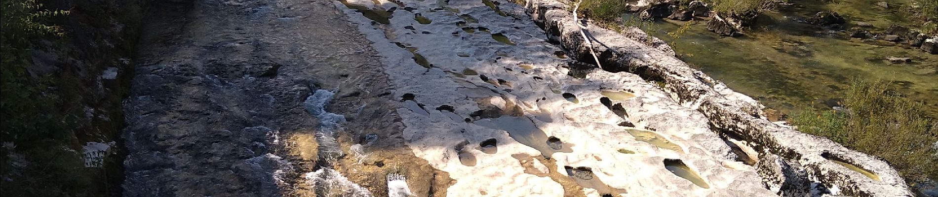
pertes de la Valserine Confort

Jackoyo
User
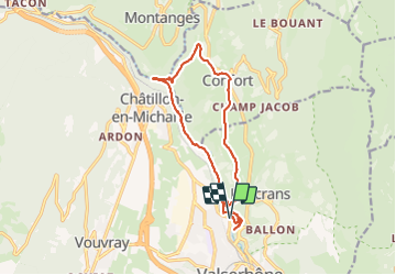

Length
14.5 km

Max alt
566 m

Uphill gradient
374 m
Km-Effort
19.5 km

Min alt
344 m

Downhill gradient
370 m
Boucle
Yes
Creation date :
2021-08-25 06:56:01.545
Updated on :
2021-08-25 14:38:49.439
4h01
Difficulty : Easy

FREE GPS app for hiking
 SityTrail
IGN / Geographical institutes
SityTrail Plus
The world is yours!
About
Trail Walking of 14.5 km to be discovered at Auvergne-Rhône-Alpes, Ain, Valserhône. This trail is proposed by Jackoyo .
Photos


21 photos in total. Please click on a photo to see them all in the gallery.
Positioning
Country:
France
Region :
Auvergne-Rhône-Alpes
Department/Province :
Ain
Municipality :
Valserhône
Location:
Bellegarde-sur-Valserine
Start:(Dec)
Start:(UTM)
718129 ; 5111263 (31T) N.
Comments