château Pontécoulant

marco14
User

Length
18.9 km

Max alt
242 m

Uphill gradient
513 m
Km-Effort
26 km

Min alt
98 m

Downhill gradient
522 m
Boucle
Yes
Creation date :
2021-08-30 08:06:03.618
Updated on :
2022-07-12 08:50:55.066
6h05
Difficulty : Medium

FREE GPS app for hiking
 SityTrail
IGN / Geographical institutes
SityTrail Plus
The world is yours!
About
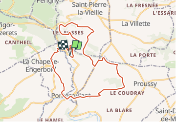
Trail On foot of 18.9 km to be discovered at Normandy, Calvados, Pontécoulant. This trail is proposed by marco14.
Positioning
Country:
France
Region :
Normandy
Department/Province :
Calvados
Municipality :
Pontécoulant
Location:
Unknown
Start:(Dec)
Start:(UTM)
676673 ; 5418798 (30U) N.
Comments