


La Condamine, le Single

Gegetop
User
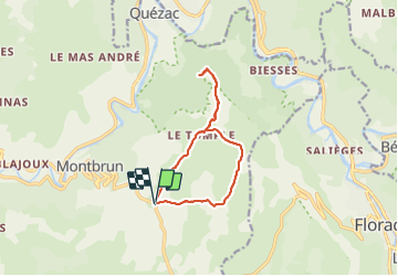

Length
11.3 km

Max alt
1052 m

Uphill gradient
259 m
Km-Effort
14.8 km

Min alt
883 m

Downhill gradient
259 m
Boucle
Yes
Creation date :
2021-08-31 09:35:38.257
Updated on :
2021-08-31 13:15:17.29
3h15
Difficulty : Easy
2h57
Difficulty : Easy

FREE GPS app for hiking
 SityTrail
IGN / Geographical institutes
SityTrail Plus
The world is yours!
About
Trail Walking of 11.3 km to be discovered at Occitania, Lozère, Gorges du Tarn Causses. This trail is proposed by Gegetop.
Description
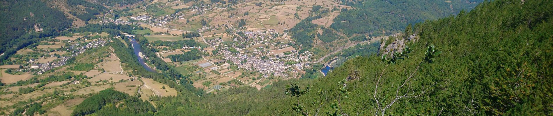
Boucle avec aller-retour au magnifique panorama du Single.
Photos


Positioning
Country:
France
Region :
Occitania
Department/Province :
Lozère
Municipality :
Gorges du Tarn Causses
Location:
Montbrun
Start:(Dec)
Start:(UTM)
541859 ; 4908489 (31T) N.
Comments