


aire de côté à l aigoual

labarone
User
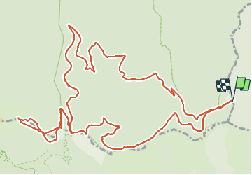

Length
18.9 km

Max alt
1557 m

Uphill gradient
679 m
Km-Effort
28 km

Min alt
997 m

Downhill gradient
678 m
Boucle
Yes
Creation date :
2021-08-31 07:57:50.077
Updated on :
2021-08-31 13:51:51.726
5h10
Difficulty : Medium

FREE GPS app for hiking
 SityTrail
IGN / Geographical institutes
SityTrail Plus
The world is yours!
About
Trail Walking of 18.9 km to be discovered at Occitania, Gard, Saint-André-de-Valborgne. This trail is proposed by labarone.
Description
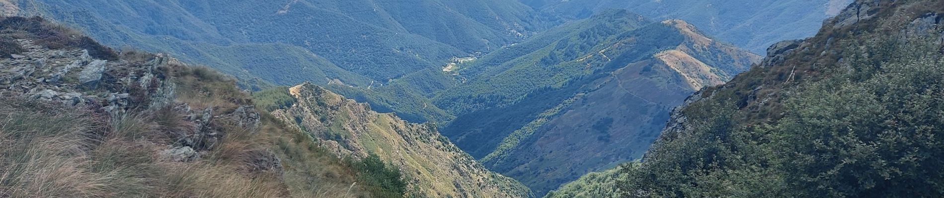
belle rando tranquille
belles vues
Photos


Positioning
Country:
France
Region :
Occitania
Department/Province :
Gard
Municipality :
Saint-André-de-Valborgne
Location:
Unknown
Start:(Dec)
Start:(UTM)
550736 ; 4885961 (31T) N.
Comments