


St- Laurent-sous-Coiron la Louyre 18Km.

chancha
User GUIDE
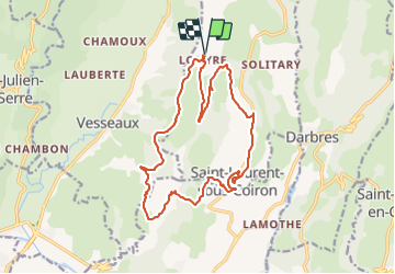

Length
18.1 km

Max alt
600 m

Uphill gradient
496 m
Km-Effort
25 km

Min alt
332 m

Downhill gradient
501 m
Boucle
Yes
Creation date :
2021-09-04 10:08:06.936
Updated on :
2025-03-17 12:26:02.417
5h36
Difficulty : Very difficult

FREE GPS app for hiking
 SityTrail
IGN / Geographical institutes
SityTrail Plus
The world is yours!
About
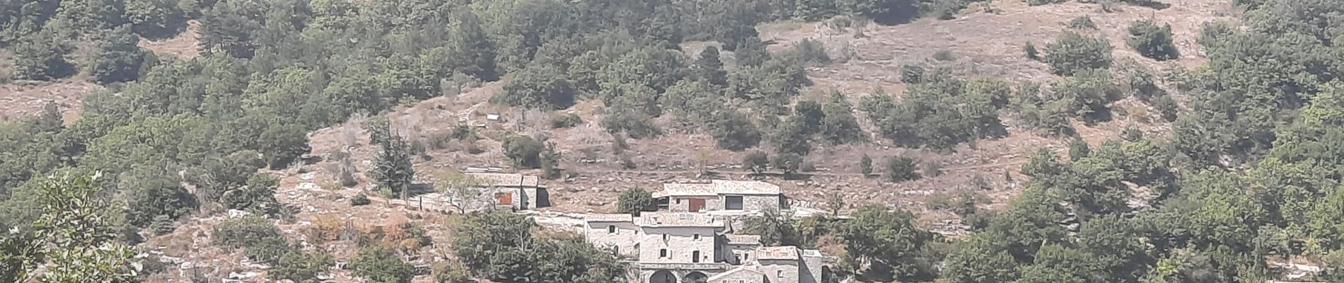
Trail Walking of 18.1 km to be discovered at Auvergne-Rhône-Alpes, Ardèche, Saint-Laurent-sous-Coiron. This trail is proposed by chancha.
Photos


Positioning
Country:
France
Region :
Auvergne-Rhône-Alpes
Department/Province :
Ardèche
Municipality :
Saint-Laurent-sous-Coiron
Location:
Unknown
Start:(Dec)
Start:(UTM)
616678 ; 4946869 (31T) N.
Comments