


Col de Laupon

raygautier
User

Length
14.2 km

Max alt
2414 m

Uphill gradient
1177 m
Km-Effort
30 km

Min alt
1240 m

Downhill gradient
1181 m
Boucle
Yes
Creation date :
2021-09-04 06:00:32.0
Updated on :
2021-09-04 12:56:21.463
6h54
Difficulty : Very difficult

FREE GPS app for hiking
 SityTrail
IGN / Geographical institutes
SityTrail Plus
The world is yours!
About
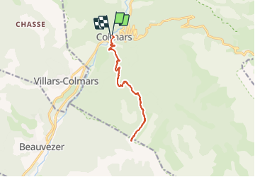
Trail Walking of 14.2 km to be discovered at Provence-Alpes-Côte d'Azur, Alpes-de-Haute-Provence, Colmars. This trail is proposed by raygautier.
Positioning
Country:
France
Region :
Provence-Alpes-Côte d'Azur
Department/Province :
Alpes-de-Haute-Provence
Municipality :
Colmars
Location:
Unknown
Start:(Dec)
Start:(UTM)
310253 ; 4894797 (32T) N.
Comments