


05.09.2021 - Gaschney

delm
User
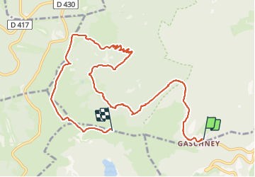

Length
11.3 km

Max alt
1351 m

Uphill gradient
556 m
Km-Effort
17.9 km

Min alt
964 m

Downhill gradient
314 m
Boucle
No
Creation date :
2021-09-05 09:08:16.0
Updated on :
2021-09-07 08:34:19.185
4h30
Difficulty : Difficult

FREE GPS app for hiking
 SityTrail
IGN / Geographical institutes
SityTrail Plus
The world is yours!
About
Trail Walking of 11.3 km to be discovered at Grand Est, Haut-Rhin, Stosswihr. This trail is proposed by delm.
Positioning
Country:
France
Region :
Grand Est
Department/Province :
Haut-Rhin
Municipality :
Stosswihr
Location:
Unknown
Start:(Dec)
Start:(UTM)
354472 ; 5322016 (32U) N.
Comments