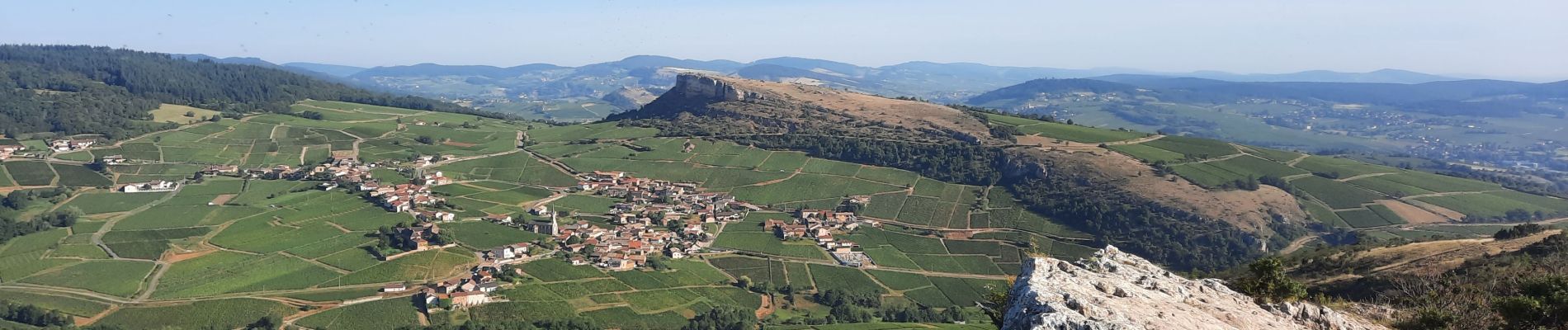
Roche de Solutré 4km

thonyc
User GUIDE
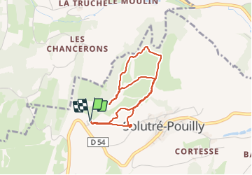

Length
3.7 km

Max alt
464 m

Uphill gradient
128 m
Km-Effort
5.5 km

Min alt
368 m

Downhill gradient
130 m
Boucle
Yes
Creation date :
2021-09-07 06:44:38.462
Updated on :
2021-11-21 08:11:05.843
2h00
Difficulty : Easy

FREE GPS app for hiking
 SityTrail
IGN / Geographical institutes
SityTrail Plus
The world is yours!
About
Trail Walking of 3.7 km to be discovered at Bourgogne-Franche-Comté, Saône-et-Loire, Solutré-Pouilly. This trail is proposed by thonyc.
Description
Très beaux panoramas sur les Roches de Solutré et de Vergisson, ainsi que sur la plaine vinicole du Macônnais
Photos


Positioning
Country:
France
Region :
Bourgogne-Franche-Comté
Department/Province :
Saône-et-Loire
Municipality :
Solutré-Pouilly
Location:
Unknown
Start:(Dec)
Start:(UTM)
632143 ; 5128515 (31T) N.
Comments