


Encombtrette

raygautier
User
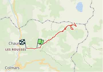

Length
16.5 km

Max alt
2543 m

Uphill gradient
988 m
Km-Effort
30 km

Min alt
1489 m

Downhill gradient
1110 m
Boucle
No
Creation date :
2021-09-08 06:47:28.0
Updated on :
2021-09-09 06:53:22.531
7h18
Difficulty : Very difficult

FREE GPS app for hiking
 SityTrail
IGN / Geographical institutes
SityTrail Plus
The world is yours!
About
Trail Walking of 16.5 km to be discovered at Provence-Alpes-Côte d'Azur, Alpes-de-Haute-Provence, Colmars. This trail is proposed by raygautier.
Positioning
Country:
France
Region :
Provence-Alpes-Côte d'Azur
Department/Province :
Alpes-de-Haute-Provence
Municipality :
Colmars
Location:
Unknown
Start:(Dec)
Start:(UTM)
312773 ; 4896561 (32T) N.
Comments