


Mont Viso

lucmarescot
User

Length
30 km

Max alt
2149 m

Uphill gradient
686 m
Km-Effort
39 km

Min alt
1543 m

Downhill gradient
684 m
Boucle
Yes
Creation date :
2021-09-11 08:57:36.0
Updated on :
2021-09-11 12:54:15.029
3h56
Difficulty : Unknown

FREE GPS app for hiking
 SityTrail
IGN / Geographical institutes
SityTrail Plus
The world is yours!
About
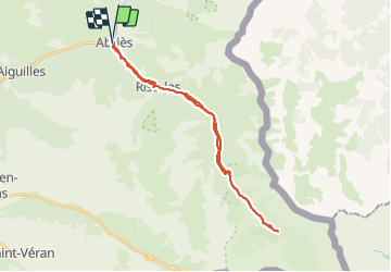
Trail Mountain bike of 30 km to be discovered at Provence-Alpes-Côte d'Azur, Hautes-Alpes, Abriès-Ristolas. This trail is proposed by lucmarescot.
Photos

Positioning
Country:
France
Region :
Provence-Alpes-Côte d'Azur
Department/Province :
Hautes-Alpes
Municipality :
Abriès-Ristolas
Location:
Unknown
Start:(Dec)
Start:(UTM)
336022 ; 4962270 (32T) N.
Comments