


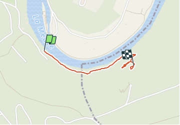
Ardoisière

Tommy Eric
User

Length
971 m

Max alt
197 m

Uphill gradient
73 m
Km-Effort
1.7 km

Min alt
128 m

Downhill gradient
10 m
Boucle
No
Creation date :
2021-09-12 08:35:05.45
Updated on :
2021-09-12 09:35:11.201
59m
Difficulty : Easy

FREE GPS app for hiking
 SityTrail
IGN / Geographical institutes
SityTrail Plus
The world is yours!
About
Trail Walking of 971 m to be discovered at Grand Est, Ardennes, Fumay. This trail is proposed by Tommy Eric.
Positioning
Country:
France
Region :
Grand Est
Department/Province :
Ardennes
Municipality :
Fumay
Location:
Unknown
Start:(Dec)
Start:(UTM)
622141 ; 5538123 (31U) N.
Comments