


Vinzelles

janussity
User
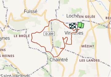

Length
7.8 km

Max alt
331 m

Uphill gradient
167 m
Km-Effort
10.1 km

Min alt
209 m

Downhill gradient
171 m
Boucle
Yes
Creation date :
2021-09-12 13:11:15.09
Updated on :
2021-09-12 15:35:31.95
2h06
Difficulty : Easy

FREE GPS app for hiking
 SityTrail
IGN / Geographical institutes
SityTrail Plus
The world is yours!
About
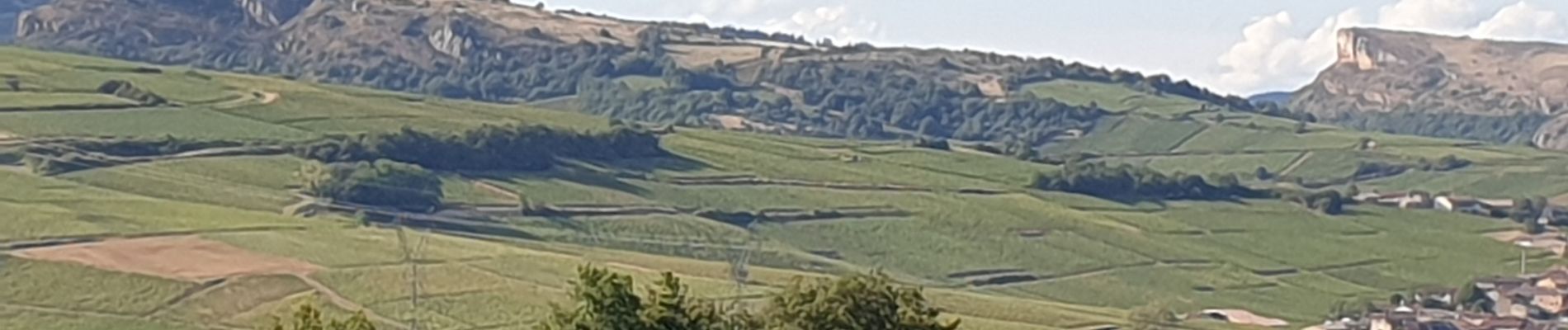
Trail Walking of 7.8 km to be discovered at Bourgogne-Franche-Comté, Saône-et-Loire, Vinzelles. This trail is proposed by janussity.
Description
Entre routes et vignes. 3 chateaux...
beau temps.
Photos


Positioning
Country:
France
Region :
Bourgogne-Franche-Comté
Department/Province :
Saône-et-Loire
Municipality :
Vinzelles
Location:
Unknown
Start:(Dec)
Start:(UTM)
636360 ; 5125771 (31T) N.
Comments
belle journée ensoleillée