


TSN PT DOUILLY THURRY

UDGI54
User

Length
29 km

Max alt
262 m

Uphill gradient
812 m
Km-Effort
40 km

Min alt
32 m

Downhill gradient
819 m
Boucle
No
Creation date :
2021-09-13 14:17:18.481
Updated on :
2021-09-13 14:18:04.518
9h09
Difficulty : Very difficult

FREE GPS app for hiking
 SityTrail
IGN / Geographical institutes
SityTrail Plus
The world is yours!
About
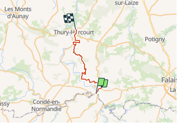
Trail Walking of 29 km to be discovered at Normandy, Calvados, Pont-d'Ouilly. This trail is proposed by UDGI54.
Positioning
Country:
France
Region :
Normandy
Department/Province :
Calvados
Municipality :
Pont-d'Ouilly
Location:
Unknown
Start:(Dec)
Start:(UTM)
689791 ; 5416395 (30U) N.
Comments