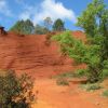
Fley la vierge du belvédère page51

grasgilbert
User
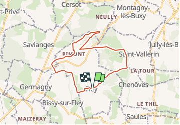

Length
14.1 km

Max alt
436 m

Uphill gradient
389 m
Km-Effort
19.3 km

Min alt
264 m

Downhill gradient
395 m
Boucle
Yes
Creation date :
2021-09-14 15:00:29.973
Updated on :
2021-09-14 15:01:21.606
4h22
Difficulty : Very difficult

FREE GPS app for hiking
 SityTrail
IGN / Geographical institutes
SityTrail Plus
The world is yours!
About
Trail Walking of 14.1 km to be discovered at Bourgogne-Franche-Comté, Saône-et-Loire, Fley. This trail is proposed by grasgilbert.
Positioning
Country:
France
Region :
Bourgogne-Franche-Comté
Department/Province :
Saône-et-Loire
Municipality :
Fley
Location:
Unknown
Start:(Dec)
Start:(UTM)
625582 ; 5169789 (31T) N.
Comments