


20210916

Frings
User
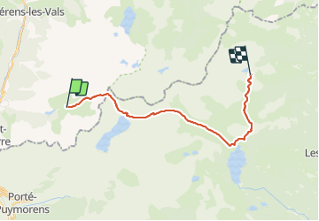

Length
21 km

Max alt
2484 m

Uphill gradient
898 m
Km-Effort
32 km

Min alt
2033 m

Downhill gradient
743 m
Boucle
No
Creation date :
2021-09-16 06:55:50.395
Updated on :
2021-09-17 08:21:04.623
9h06
Difficulty : Very difficult

FREE GPS app for hiking
 SityTrail
IGN / Geographical institutes
SityTrail Plus
The world is yours!
About
Trail Walking of 21 km to be discovered at Occitania, Ariège, Mérens-les-Vals. This trail is proposed by Frings.
Positioning
Country:
France
Region :
Occitania
Department/Province :
Ariège
Municipality :
Mérens-les-Vals
Location:
Unknown
Start:(Dec)
Start:(UTM)
407177 ; 4717435 (31T) N.
Comments