


Montagne de Lure

PhilippeC54
User
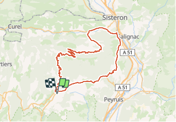

Length
79 km

Max alt
1748 m

Uphill gradient
1622 m
Km-Effort
100 km

Min alt
453 m

Downhill gradient
1622 m
Boucle
Yes
Creation date :
2021-09-17 07:26:21.632
Updated on :
2021-09-17 14:46:53.403
4h45
Difficulty : Difficult

FREE GPS app for hiking
 SityTrail
IGN / Geographical institutes
SityTrail Plus
The world is yours!
About
Trail Road bike of 79 km to be discovered at Provence-Alpes-Côte d'Azur, Alpes-de-Haute-Provence, Saint-Étienne-les-Orgues. This trail is proposed by PhilippeC54.
Positioning
Country:
France
Region :
Provence-Alpes-Côte d'Azur
Department/Province :
Alpes-de-Haute-Provence
Municipality :
Saint-Étienne-les-Orgues
Location:
Unknown
Start:(Dec)
Start:(UTM)
722910 ; 4880185 (31T) N.
Comments