


JANIN_THIERRY_2021-09-12_08-28-48

ThierryJ01
User

Length
36 km

Max alt
321 m

Uphill gradient
298 m
Km-Effort
40 km

Min alt
265 m

Downhill gradient
298 m
Boucle
Yes
Creation date :
2021-09-19 18:58:16.794
Updated on :
2021-09-19 19:11:38.571
2h45
Difficulty : Difficult

FREE GPS app for hiking
 SityTrail
IGN / Geographical institutes
SityTrail Plus
The world is yours!
About
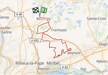
Trail Mountain bike of 36 km to be discovered at Auvergne-Rhône-Alpes, Ain, Mionnay. This trail is proposed by ThierryJ01.
Description
Singles de la cotière
Positioning
Country:
France
Region :
Auvergne-Rhône-Alpes
Department/Province :
Ain
Municipality :
Mionnay
Location:
Unknown
Start:(Dec)
Start:(UTM)
649153 ; 5084439 (31T) N.
Comments