


Vauvert

Dupuybadonniere
User
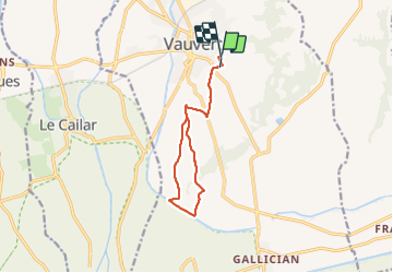

Length
11.3 km

Max alt
76 m

Uphill gradient
89 m
Km-Effort
12.4 km

Min alt
17 m

Downhill gradient
85 m
Boucle
No
Creation date :
2021-09-21 12:24:13.277
Updated on :
2021-09-21 14:56:09.235
2h27
Difficulty : Difficult

FREE GPS app for hiking
 SityTrail
IGN / Geographical institutes
SityTrail Plus
The world is yours!
About
Trail Walking of 11.3 km to be discovered at Occitania, Gard, Vauvert. This trail is proposed by Dupuybadonniere.
Positioning
Country:
France
Region :
Occitania
Department/Province :
Gard
Municipality :
Vauvert
Location:
Unknown
Start:(Dec)
Start:(UTM)
603474 ; 4837903 (31T) N.
Comments