


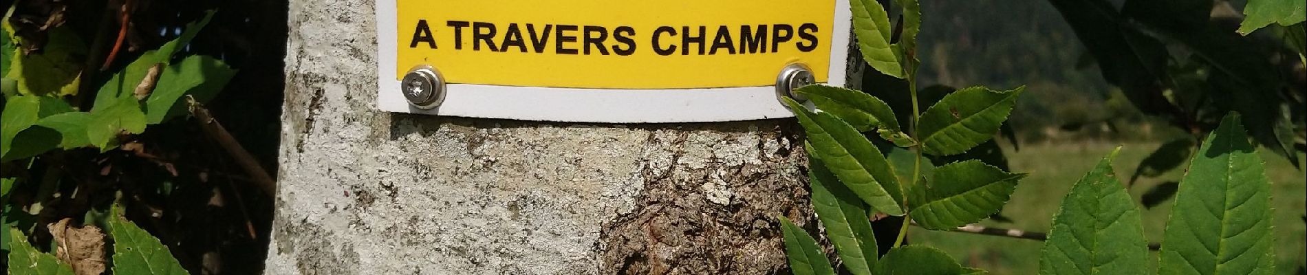
À travers champs

Gegetop
User

Length
13.6 km

Max alt
894 m

Uphill gradient
233 m
Km-Effort
16.7 km

Min alt
802 m

Downhill gradient
233 m
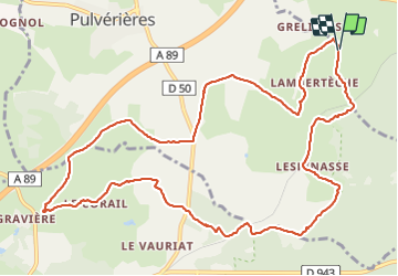
Boucle
Yes
Creation date :
2021-09-24 10:11:49.412
Updated on :
2021-09-24 14:45:24.23
2h50
Difficulty : Easy

FREE GPS app for hiking
 SityTrail
IGN / Geographical institutes
SityTrail Plus
The world is yours!
About
Trail Nordic walking of 13.6 km to be discovered at Auvergne-Rhône-Alpes, Puy-de-Dôme, Pulvérières. This trail is proposed by Gegetop.
Description
Boucle bien balisée avec des petits panneaux.
Agréable.
Photos


Positioning
Country:
France
Region :
Auvergne-Rhône-Alpes
Department/Province :
Puy-de-Dôme
Municipality :
Pulvérières
Location:
Unknown
Start:(Dec)
Start:(UTM)
495751 ; 5081062 (31T) N.
Comments