


lava

Jean Marc
User

Length
12 km

Max alt
449 m

Uphill gradient
447 m
Km-Effort
18 km

Min alt
346 m

Downhill gradient
457 m
Boucle
No
Creation date :
2021-09-26 06:36:31.229
Updated on :
2021-09-26 09:47:56.928
2h47
Difficulty : Difficult

FREE GPS app for hiking
 SityTrail
IGN / Geographical institutes
SityTrail Plus
The world is yours!
About
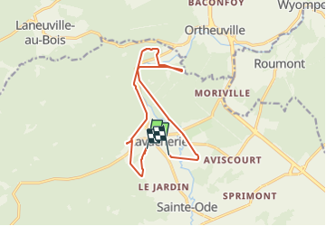
Trail Walking of 12 km to be discovered at Wallonia, Luxembourg, Sainte-Ode. This trail is proposed by Jean Marc .
Positioning
Country:
Belgium
Region :
Wallonia
Department/Province :
Luxembourg
Municipality :
Sainte-Ode
Location:
Unknown
Start:(Dec)
Start:(UTM)
679633 ; 5547271 (31U) N.
Comments