


Thueyts

raygautier
User
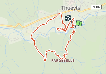

Length
6.5 km

Max alt
601 m

Uphill gradient
301 m
Km-Effort
10.5 km

Min alt
376 m

Downhill gradient
320 m
Boucle
Yes
Creation date :
2021-09-26 12:47:10.0
Updated on :
2021-09-26 16:15:33.659
3h27
Difficulty : Medium

FREE GPS app for hiking
 SityTrail
IGN / Geographical institutes
SityTrail Plus
The world is yours!
About
Trail Walking of 6.5 km to be discovered at Auvergne-Rhône-Alpes, Ardèche, Thueyts. This trail is proposed by raygautier.
Positioning
Country:
France
Region :
Auvergne-Rhône-Alpes
Department/Province :
Ardèche
Municipality :
Thueyts
Location:
Unknown
Start:(Dec)
Start:(UTM)
596925 ; 4947132 (31T) N.
Comments