


arsel saint martial

labarone
User
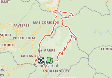

Length
22 km

Max alt
1147 m

Uphill gradient
891 m
Km-Effort
34 km

Min alt
413 m

Downhill gradient
892 m
Boucle
Yes
Creation date :
2021-09-28 06:52:26.422
Updated on :
2021-09-28 14:30:14.645
7h32
Difficulty : Medium

FREE GPS app for hiking
 SityTrail
IGN / Geographical institutes
SityTrail Plus
The world is yours!
About
Trail Walking of 22 km to be discovered at Occitania, Gard, Saint-Martial. This trail is proposed by labarone.
Description
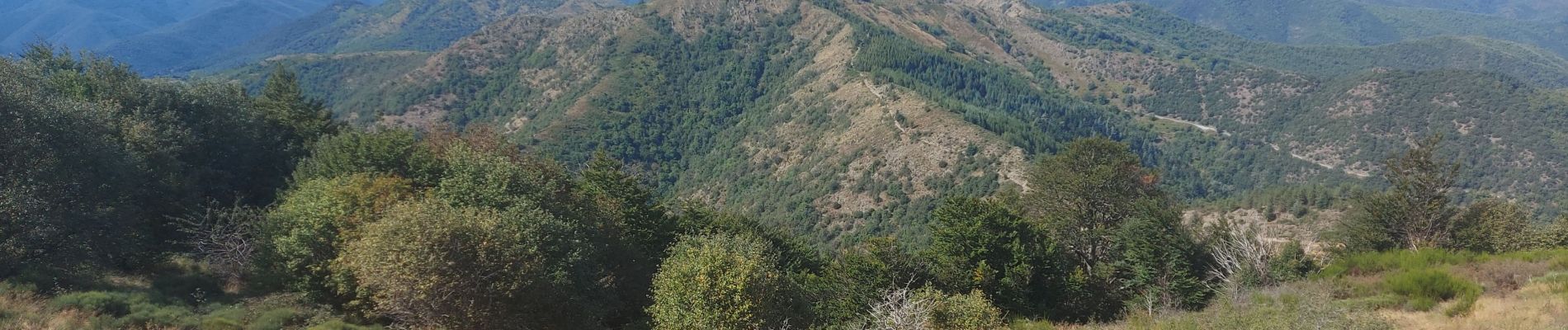
belle rando
Photos


Positioning
Country:
France
Region :
Occitania
Department/Province :
Gard
Municipality :
Saint-Martial
Location:
Unknown
Start:(Dec)
Start:(UTM)
558904 ; 4875865 (31T) N.
Comments