


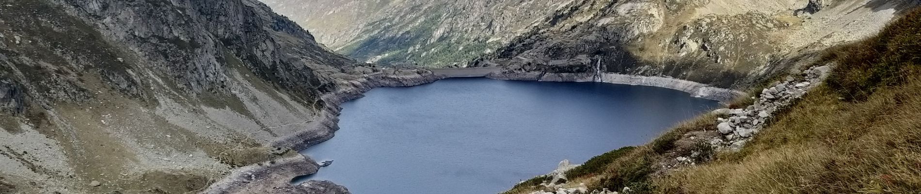
Du lac d'Artouste au refuge d'Arrémoulit

micheldutilleul
User
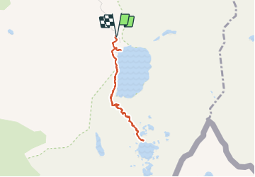

Length
7 km

Max alt
2276 m

Uphill gradient
418 m
Km-Effort
12.5 km

Min alt
1917 m

Downhill gradient
422 m
Boucle
Yes
Creation date :
2021-09-28 09:01:03.241
Updated on :
2021-10-03 09:18:00.796
3h07
Difficulty : Medium

FREE GPS app for hiking
 SityTrail
IGN / Geographical institutes
SityTrail Plus
The world is yours!
About
Trail Walking of 7 km to be discovered at New Aquitaine, Pyrénées-Atlantiques, Laruns. This trail is proposed by micheldutilleul.
Photos


Positioning
Country:
France
Region :
New Aquitaine
Department/Province :
Pyrénées-Atlantiques
Municipality :
Laruns
Location:
Unknown
Start:(Dec)
Start:(UTM)
717652 ; 4749214 (30T) N.
Comments