


SityTrail - 2656269 - chantemerle-clansayes-15km

thonyc
User GUIDE
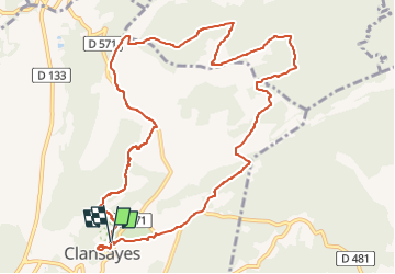

Length
12.4 km

Max alt
353 m

Uphill gradient
260 m
Km-Effort
15.8 km

Min alt
139 m

Downhill gradient
263 m
Boucle
Yes
Creation date :
2021-10-02 13:00:14.055
Updated on :
2022-06-06 15:34:30.263
3h00
Difficulty : Easy

FREE GPS app for hiking
 SityTrail
IGN / Geographical institutes
SityTrail Plus
The world is yours!
About
Trail Walking of 12.4 km to be discovered at Auvergne-Rhône-Alpes, Drôme, Clansayes. This trail is proposed by thonyc.
Description
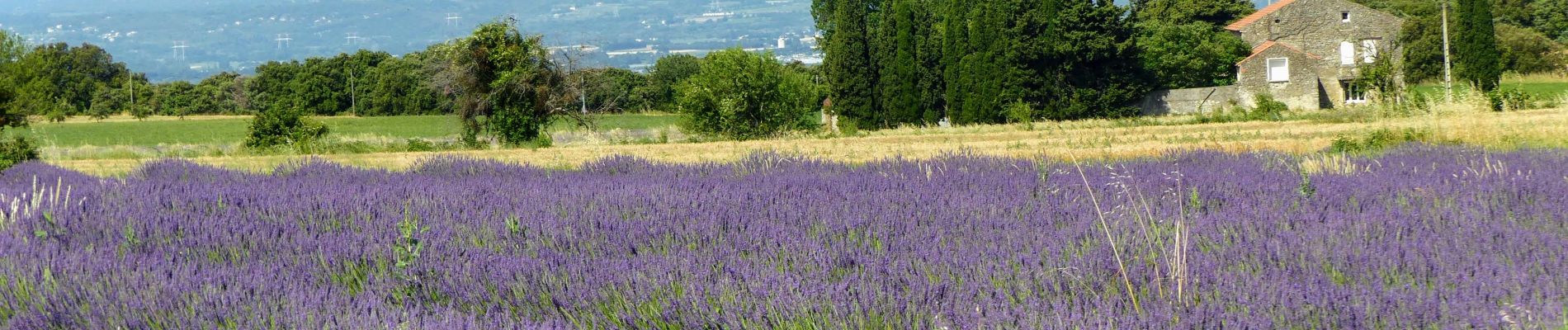
Très jolie rando.
Village très bien restauré.
Les Jumelles de Rozet.
Le plateau du Rouvergue et ses champs de lavandes.
De belles vues sur la vallée du Rhône.
Photos


Positioning
Country:
France
Region :
Auvergne-Rhône-Alpes
Department/Province :
Drôme
Municipality :
Clansayes
Location:
Unknown
Start:(Dec)
Start:(UTM)
644067 ; 4914795 (31T) N.
Comments