Trail Walking Arras-en-Lavedan - Sur la hauteur de Sireix - Photo

Sur la hauteur de Sireix

© OpenStreetMap contributors
Length
Length
11.4 km
Max alt
Max alt
1578 m
Uphill gradient
Uphill gradient
461 m
Km-Effort
Km-Effort  
17.6 km
Min alt
Min alt
1156 m
Downhill gradient
Downhill gradient
460 m
Boucle
Boucle
Yes
Creation date :
2021-10-02 09:02:02.326
Updated on :
2021-10-03 09:32:10.075

(0 Reviews)

Walking
Walking
3h20
Difficulty : Difficult

Scan this QR Code to open this trail in the SityTrail application

FREE GPS app for hiking

Logo SityTrail SityTrail

IGN / Geographical institutes

Download SityTrail from the App Store Download SityTrail from Google Play

Logo SityTrail SityTrail Plus

The world is yours!

Download SityTrail from the App Store Download SityTrail from Google Play Download SityTrail on Huawei AppGallery

About

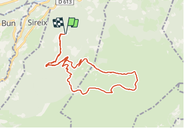
Trail Walking of 11.4 km to be discovered at Occitania, Hautespyrenees, Arras-en-Lavedan. This trail is proposed by micheldutilleul.

Description

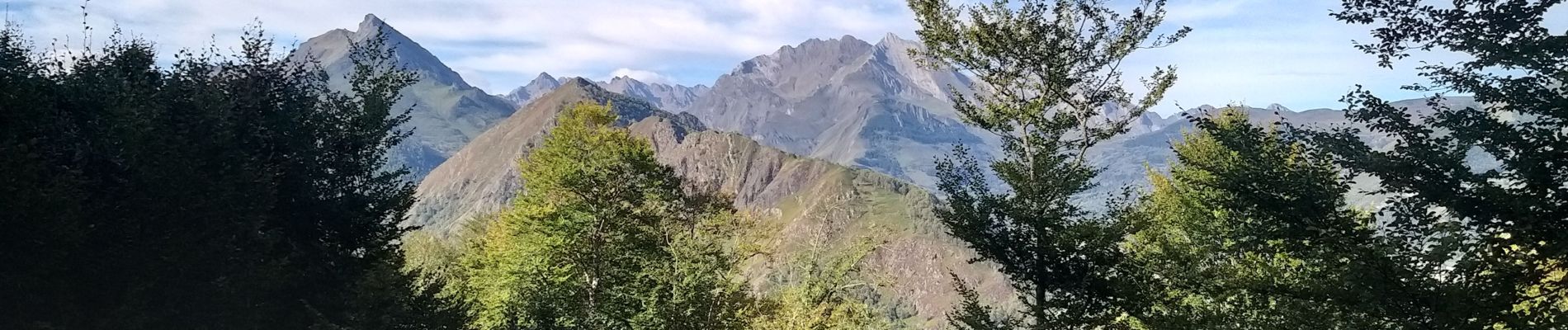
Randonnée faite au début de l'automne, au milieu des colchiques.
Passage par les cabanes d'Artigue, de Turon de Béne, de l'Abedet.
Des vues panoramiques à pertes de vues ...
Attention à ne pas s'égarer sur les sentiers au travers des bruyères et des fougères ...

Elevation profile

Photos

Positioning

Country:
France
Region :
Occitania
Department/Province :
Hautespyrenees
Municipality :
Arras-en-Lavedan
Location:
Unknown
Start:(UTM)
733395 ; 4761734 (30T) N.


Close
My subscriptions