


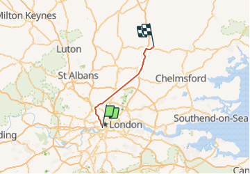
stansted

papagenopier
User

Length
64 km

Max alt
112 m

Uphill gradient
571 m
Km-Effort
71 km

Min alt
12 m

Downhill gradient
480 m
Boucle
No
Creation date :
2021-10-05 14:26:19.122
Updated on :
2021-10-05 16:46:11.493
1h36
Difficulty : Very easy

FREE GPS app for hiking
 SityTrail
IGN / Geographical institutes
SityTrail Plus
The world is yours!
About
Trail Car of 64 km to be discovered at England, London, Westminster. This trail is proposed by papagenopier.
Positioning
Country:
United Kingdom
Region :
England
Department/Province :
London
Municipality :
Westminster
Location:
Unknown
Start:(Dec)
Start:(UTM)
697908 ; 5708469 (30U) N.
Comments