Soyans 17km

thonyc
User GUIDE
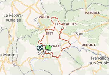

Length
15.5 km

Max alt
527 m

Uphill gradient
397 m
Km-Effort
21 km

Min alt
284 m

Downhill gradient
396 m
Boucle
Yes
Creation date :
2021-10-07 14:00:11.228
Updated on :
2021-10-15 18:51:18.274
5h00
Difficulty : Medium

FREE GPS app for hiking
 SityTrail
IGN / Geographical institutes
SityTrail Plus
The world is yours!
About
Trail Walking of 15.5 km to be discovered at Auvergne-Rhône-Alpes, Drôme, Soyans. This trail is proposed by thonyc.
Description
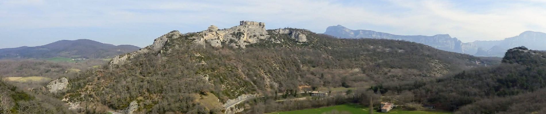
Parcours très diversifié offrant de belles vues sur la plaine et sur Rochecolombe.
Beau village fortifié
Photos


Positioning
Country:
France
Region :
Auvergne-Rhône-Alpes
Department/Province :
Drôme
Municipality :
Soyans
Location:
Unknown
Start:(Dec)
Start:(UTM)
660418 ; 4943717 (31T) N.
Comments