


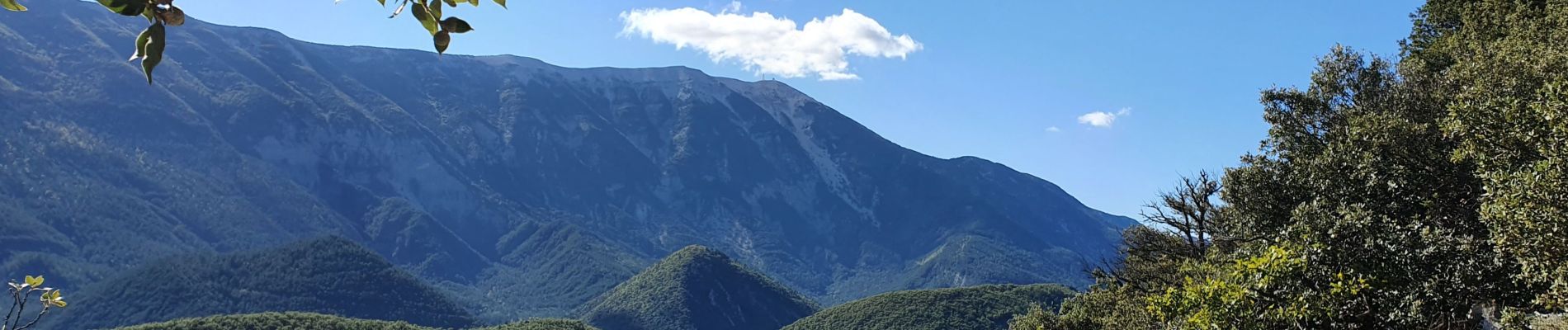
Brantes - Savoillan

MarcLEBARON
User
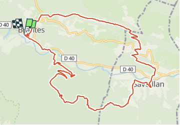

Length
15.2 km

Max alt
826 m

Uphill gradient
690 m
Km-Effort
24 km

Min alt
459 m

Downhill gradient
678 m
Boucle
Yes
Creation date :
2021-10-07 07:39:16.619
Updated on :
2021-10-08 16:35:28.633
4h49
Difficulty : Medium

FREE GPS app for hiking
 SityTrail
IGN / Geographical institutes
SityTrail Plus
The world is yours!
About
Trail Walking of 15.2 km to be discovered at Provence-Alpes-Côte d'Azur, Vaucluse, Brantes. This trail is proposed by MarcLEBARON.
Photos


Positioning
Country:
France
Region :
Provence-Alpes-Côte d'Azur
Department/Province :
Vaucluse
Municipality :
Brantes
Location:
Unknown
Start:(Dec)
Start:(UTM)
686315 ; 4895828 (31T) N.
Comments