


Ailhon

Did JP
User
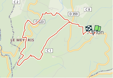

Length
6.3 km

Max alt
461 m

Uphill gradient
215 m
Km-Effort
9.2 km

Min alt
317 m

Downhill gradient
214 m
Boucle
Yes
Creation date :
2021-10-08 17:02:59.849
Updated on :
2021-10-08 17:03:02.466
2h05
Difficulty : Medium

FREE GPS app for hiking
 SityTrail
IGN / Geographical institutes
SityTrail Plus
The world is yours!
About
Trail Walking of 6.3 km to be discovered at Auvergne-Rhône-Alpes, Ardèche, Ailhon. This trail is proposed by Did JP.
Description
village au clocher particulier, dans un écrin de verdure.
Positioning
Country:
France
Region :
Auvergne-Rhône-Alpes
Department/Province :
Ardèche
Municipality :
Ailhon
Location:
Unknown
Start:(Dec)
Start:(UTM)
606445 ; 4939093 (31T) N.
Comments