


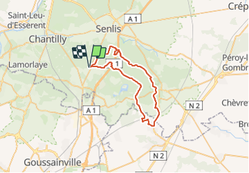
Pontarmé jusque Otis

domifon
User

Length
43 km

Max alt
127 m

Uphill gradient
433 m
Km-Effort
49 km

Min alt
53 m

Downhill gradient
433 m
Boucle
Yes
Creation date :
2021-10-10 07:13:55.0
Updated on :
2021-10-10 10:45:23.847
3h30
Difficulty : Medium

FREE GPS app for hiking
 SityTrail
IGN / Geographical institutes
SityTrail Plus
The world is yours!
About
Trail Mountain bike of 43 km to be discovered at Hauts-de-France, Oise, Pontarmé. This trail is proposed by domifon.
Positioning
Country:
France
Region :
Hauts-de-France
Department/Province :
Oise
Municipality :
Pontarmé
Location:
Unknown
Start:(Dec)
Start:(UTM)
467032 ; 5444899 (31U) N.
Comments