


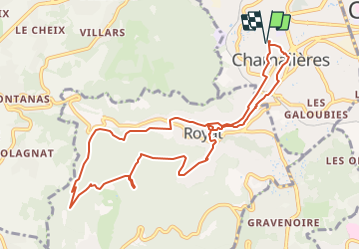
Le chemin des écoliers par la Tiretaine et le vieux Royat.

jpcccb
User

Length
10.7 km

Max alt
814 m

Uphill gradient
403 m
Km-Effort
16.1 km

Min alt
419 m

Downhill gradient
403 m
Boucle
Yes
Creation date :
2021-10-13 14:32:05.998
Updated on :
2021-10-13 15:31:44.964
3h40
Difficulty : Difficult

FREE GPS app for hiking
 SityTrail
IGN / Geographical institutes
SityTrail Plus
The world is yours!
About
Trail Walking of 10.7 km to be discovered at Auvergne-Rhône-Alpes, Puy-de-Dôme, Chamalières. This trail is proposed by jpcccb.
Positioning
Country:
France
Region :
Auvergne-Rhône-Alpes
Department/Province :
Puy-de-Dôme
Municipality :
Chamalières
Location:
Unknown
Start:(Dec)
Start:(UTM)
504558 ; 5069073 (31T) N.
Comments