


Val croissant

raygautier
User
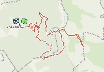

Length
17.4 km

Max alt
2033 m

Uphill gradient
1617 m
Km-Effort
39 km

Min alt
661 m

Downhill gradient
1616 m
Boucle
Yes
Creation date :
2021-10-14 06:51:21.0
Updated on :
2021-10-15 14:35:54.035
8h58
Difficulty : Very difficult

FREE GPS app for hiking
 SityTrail
IGN / Geographical institutes
SityTrail Plus
The world is yours!
About
Trail Walking of 17.4 km to be discovered at Auvergne-Rhône-Alpes, Drôme, Die. This trail is proposed by raygautier.
Positioning
Country:
France
Region :
Auvergne-Rhône-Alpes
Department/Province :
Drôme
Municipality :
Die
Location:
Unknown
Start:(Dec)
Start:(UTM)
692594 ; 4957531 (31T) N.
Comments