


Le pilonnage

raygautier
User
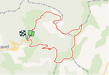

Length
12 km

Max alt
1685 m

Uphill gradient
765 m
Km-Effort
22 km

Min alt
1083 m

Downhill gradient
764 m
Boucle
Yes
Creation date :
2021-10-17 07:20:49.0
Updated on :
2021-10-17 14:00:13.099
6h37
Difficulty : Very difficult

FREE GPS app for hiking
 SityTrail
IGN / Geographical institutes
SityTrail Plus
The world is yours!
About
Trail Walking of 12 km to be discovered at Auvergne-Rhône-Alpes, Drôme, Val-Maravel. This trail is proposed by raygautier.
Positioning
Country:
France
Region :
Auvergne-Rhône-Alpes
Department/Province :
Drôme
Municipality :
Val-Maravel
Location:
Unknown
Start:(Dec)
Start:(UTM)
706417 ; 4941070 (31T) N.
Comments