


vals les bains

raab
User

Length
6.7 km

Max alt
443 m

Uphill gradient
313 m
Km-Effort
10.9 km

Min alt
240 m

Downhill gradient
313 m
Boucle
Yes
Creation date :
2021-10-17 14:09:45.974
Updated on :
2021-10-17 14:10:38.197
2h28
Difficulty : Medium

FREE GPS app for hiking
 SityTrail
IGN / Geographical institutes
SityTrail Plus
The world is yours!
About
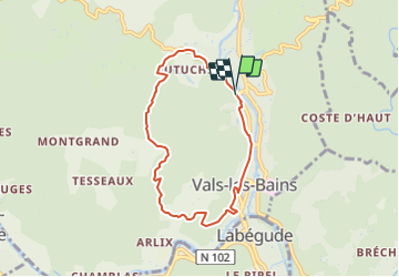
Trail Walking of 6.7 km to be discovered at Auvergne-Rhône-Alpes, Ardèche, Vals-les-Bains. This trail is proposed by raab.
Positioning
Country:
France
Region :
Auvergne-Rhône-Alpes
Department/Province :
Ardèche
Municipality :
Vals-les-Bains
Location:
Unknown
Start:(Dec)
Start:(UTM)
608155 ; 4946706 (31T) N.
Comments