


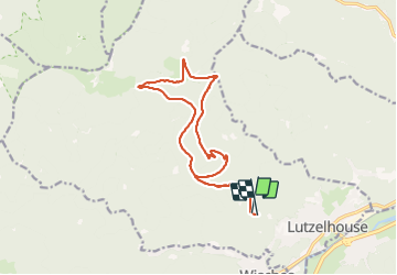
17.10.21 - Lutzelhouse

delm
User

Length
15.1 km

Max alt
1000 m

Uphill gradient
712 m
Km-Effort
25 km

Min alt
396 m

Downhill gradient
713 m
Boucle
Yes
Creation date :
2021-10-17 09:04:07.0
Updated on :
2021-10-17 14:57:55.52
4h06
Difficulty : Very difficult

FREE GPS app for hiking
 SityTrail
IGN / Geographical institutes
SityTrail Plus
The world is yours!
About
Trail Walking of 15.1 km to be discovered at Grand Est, Bas-Rhin, Lutzelhouse. This trail is proposed by delm.
Positioning
Country:
France
Region :
Grand Est
Department/Province :
Bas-Rhin
Municipality :
Lutzelhouse
Location:
Unknown
Start:(Dec)
Start:(UTM)
371827 ; 5375840 (32U) N.
Comments