


cossinade A

ballay
User
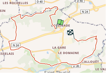

Length
11.8 km

Max alt
107 m

Uphill gradient
168 m
Km-Effort
14 km

Min alt
41 m

Downhill gradient
164 m
Boucle
No
Creation date :
2021-10-20 15:38:17.494
Updated on :
2021-10-20 15:38:47.295
3h10
Difficulty : Easy

FREE GPS app for hiking
 SityTrail
IGN / Geographical institutes
SityTrail Plus
The world is yours!
About
Trail On foot of 11.8 km to be discovered at Brittany, Ille-et-Vilaine, Saint-Thurial. This trail is proposed by ballay.
Positioning
Country:
France
Region :
Brittany
Department/Province :
Ille-et-Vilaine
Municipality :
Saint-Thurial
Location:
Unknown
Start:(Dec)
Start:(UTM)
579606 ; 5322035 (30U) N.
Comments