


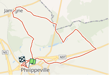
BruBer : Boucle Philippeville-Jamagne

Bruno Berlemont
User


2h43
Difficulty : Easy

FREE GPS app for hiking
 SityTrail
IGN / Geographical institutes
SityTrail Plus
The world is yours!
About
Trail Walking of 12 km to be discovered at Wallonia, Namur, Philippeville. This trail is proposed by Bruno Berlemont .
Description
# Départ : parking des Mutualités Solidaris. possibilité de rejoindre la boucle au départ de la place d'Armes.
# Descriptif : une majorité de chemins de campagne. une petite portion dans les bois.
# Points noirs : Traversée de la RN97 tronçon de RN de /- 300m aux alentours du km6
Photos


Positioning
Comments