


Val auge val par gros chêne

audrey54
User
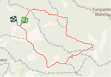

Length
19.5 km

Max alt
633 m

Uphill gradient
594 m
Km-Effort
27 km

Min alt
326 m

Downhill gradient
599 m
Boucle
No
Creation date :
2021-10-26 08:14:28.0
Updated on :
2021-10-26 15:32:22.825
4h10
Difficulty : Very difficult

FREE GPS app for hiking
 SityTrail
IGN / Geographical institutes
SityTrail Plus
The world is yours!
About
Trail Walking of 19.5 km to be discovered at Grand Est, Meurthe-et-Moselle, Val-et-Châtillon. This trail is proposed by audrey54.
Positioning
Country:
France
Region :
Grand Est
Department/Province :
Meurthe-et-Moselle
Municipality :
Val-et-Châtillon
Location:
Unknown
Start:(Dec)
Start:(UTM)
352606 ; 5380268 (32U) N.
Comments