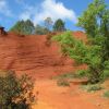
Mercurey Les Grands Crus page 27

grasgilbert
User
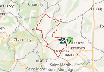

Length
13.3 km

Max alt
399 m

Uphill gradient
342 m
Km-Effort
17.8 km

Min alt
230 m

Downhill gradient
343 m
Boucle
Yes
Creation date :
2021-11-04 12:24:59.174
Updated on :
2021-11-04 17:06:28.058
4h15
Difficulty : Medium

FREE GPS app for hiking
 SityTrail
IGN / Geographical institutes
SityTrail Plus
The world is yours!
About
Trail Walking of 13.3 km to be discovered at Bourgogne-Franche-Comté, Saône-et-Loire, Mercurey. This trail is proposed by grasgilbert.
Positioning
Country:
France
Region :
Bourgogne-Franche-Comté
Department/Province :
Saône-et-Loire
Municipality :
Mercurey
Location:
Bourgneuf-Val-d'Or
Start:(Dec)
Start:(UTM)
631203 ; 5188010 (31T) N.
Comments