Trail Walking Saint-Léger-sous-Beuvray -

"Sur les traces de l'histoire" à Saint-Léger-sous-Beuvray

© OpenStreetMap contributors
Length
Length
12.2 km
Max alt
Max alt
488 m
Uphill gradient
Uphill gradient
303 m
Km-Effort
Km-Effort  
16.2 km
Min alt
Min alt
306 m
Downhill gradient
Downhill gradient
303 m
Boucle
Boucle
Yes
Creation date :
2021-11-05 09:28:26.98
Updated on :
2022-02-28 09:29:34.408

(0 Reviews)

Walking
Walking
3h41
Difficulty : Difficult

Scan this QR Code to open this trail in the SityTrail application

FREE GPS app for hiking

Logo SityTrail SityTrail

IGN / Geographical institutes

Download SityTrail from the App Store Download SityTrail from Google Play

Logo SityTrail SityTrail World

The world is yours!

Download SityTrail from the App Store Download SityTrail from Google Play Download SityTrail on Huawei AppGallery

About

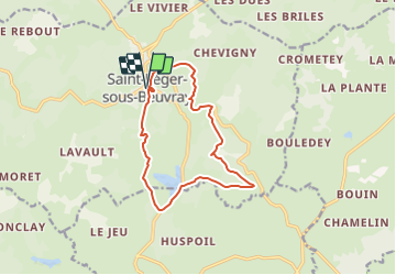
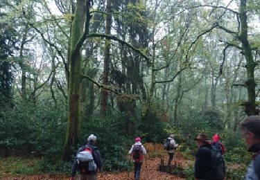
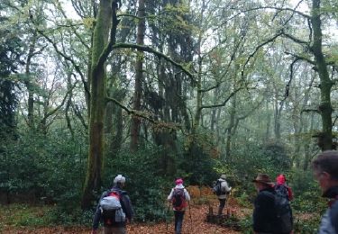
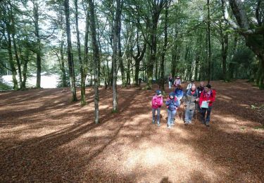
Trail Walking of 12.2 km to be discovered at Bourgogne-Franche-Comté, Saône-et-Loire, Saint-Léger-sous-Beuvray. This trail is proposed by LucThomaere.

Description

Départ : place du village  Prendre la route à gauche en passant devant l’église, au stop prendre à gauche et tourner 1re route à droite, faire 250m, tourner à gauche et aussitôt à droite direction « Maison du Beuvray » faire 800m, en face de celle-ci, prendre le chemin de terre à droite, faire 300m et aller à gauche, passer la barrière et arriver à Chardonnet, rejoindre la D61, tourner à gauche, suivre la route 800m puis tourner à droite, faire 100m sur le chemin, aller à gauche et suivre le chemin principal. Environ 2km plus loin, arrivé à la « Pryelle » tourner à droite jusqu'à Poisson, arrivé sur la route, tourner à gauche faire 700m et tourner à droite. Prendre le chemin 200m et tourner à droite, suivre tout droit 2km jusqu’à Molnet, là, tourner à droite et suivre la route sur 1,500km jusqu’à la place de St Léger sous Beuvray.

Elevation profile

Positioning

Country:
France
Region :
Bourgogne-Franche-Comté
Department/Province :
Saône-et-Loire
Municipality :
Saint-Léger-sous-Beuvray
Location:
Unknown
Start:(UTM)
583836 ; 5197143 (31T) N.

Trails nearby

Trail Walking Saint-Léger-sous-Beuvray - la chataigneraie - Photo
Walking
martinjacque

Walking

Very easy
(1)
Saint-Léger-sous-Beuvray, Bourgogne-Franche-Comté, Saône-et-Loire, France
6.2 km | 8 km-effort
1h 44min
Yes
Trail On foot Saint-Léger-sous-Beuvray - La Ronde des Mineurs - Photo
On foot
PRO

On foot

Medium
Saint-Léger-sous-Beuvray, Bourgogne-Franche-Comté, Saône-et-Loire, France
19 km | 27 km-effort
6h 6min
No
Trail Walking Saint-Léger-sous-Beuvray - Des manoirs en seigneuries - Photo
Walking
martinjacque

Walking

Easy
(1)
Saint-Léger-sous-Beuvray, Bourgogne-Franche-Comté, Saône-et-Loire, France
7.1 km | 9.9 km-effort
2h 5min
Yes
Trail On foot Glux-en-Glenne - Le Chemin de Maraude - Photo
On foot
PRO

On foot

Easy
Glux-en-Glenne, Bourgogne-Franche-Comté, Nièvre, France
3.1 km | 4 km-effort
54min
Yes
Trail Walking Saint-Léger-sous-Beuvray - 181007 SVG - Photo
Walking
MarcheEtReve

Walking

Very easy
Saint-Léger-sous-Beuvray, Bourgogne-Franche-Comté, Saône-et-Loire, France
9.3 km | 13.5 km-effort
4h 1min
Yes
Trail Walking Saint-Léger-sous-Beuvray - 181007 EnCours-2 - Photo
Walking
MarcheEtReve

Walking

Very easy
Saint-Léger-sous-Beuvray, Bourgogne-Franche-Comté, Saône-et-Loire, France
9.3 km | 13.5 km-effort
4h 1min
Yes
Trail Walking Saint-Prix - Manu-161010 - Morvan-MontBeuvray - Photo
Walking
randodan

Walking

Easy
Saint-Prix, Bourgogne-Franche-Comté, Saône-et-Loire, France
22 km | 33 km-effort
6h 30min
Yes
Trail Walking Glux-en-Glenne - Marche Expérimentale Légion VIII Augusta - Bibracte - Arleuf - Photo
Walking
tracegps

Walking

Difficult
Glux-en-Glenne, Bourgogne-Franche-Comté, Nièvre, France
19.3 km | 27 km-effort
5h 0min
No
Trail On foot La Comelle - Le Jeu et les Moulins - Photo
On foot
PRO

On foot

Easy
La Comelle, Bourgogne-Franche-Comté, Saône-et-Loire, France
4.8 km | 6.1 km-effort
1h 22min
No


Close
My subscriptions