


Allan 7km

thonyc
User GUIDE
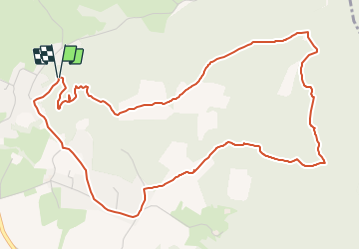

Length
6.6 km

Max alt
307 m

Uphill gradient
142 m
Km-Effort
8.5 km

Min alt
192 m

Downhill gradient
146 m
Boucle
Yes
Creation date :
2021-11-14 10:17:18.268
Updated on :
2021-11-14 10:21:07.513
2h10
Difficulty : Easy

FREE GPS app for hiking
 SityTrail
IGN / Geographical institutes
SityTrail Plus
The world is yours!
About
Trail Walking of 6.6 km to be discovered at Auvergne-Rhône-Alpes, Drôme, Allan. This trail is proposed by thonyc.
Description
Au fil de l'eau, laissez vous guider, du Roubion à la ViaRhôna : une halte pique-nique s'impose sur les berges ombragées !
Positioning
Country:
France
Region :
Auvergne-Rhône-Alpes
Department/Province :
Drôme
Municipality :
Allan
Location:
Unknown
Start:(Dec)
Start:(UTM)
642768 ; 4928851 (31T) N.
Comments