


Plateau Lambert

le boss
User
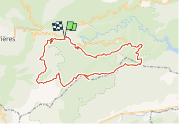

Length
22 km

Max alt
639 m

Uphill gradient
569 m
Km-Effort
29 km

Min alt
312 m

Downhill gradient
562 m
Boucle
Yes
Creation date :
2021-11-16 07:54:30.322
Updated on :
2021-11-16 14:55:35.693
6h59
Difficulty : Medium

FREE GPS app for hiking
 SityTrail
IGN / Geographical institutes
SityTrail Plus
The world is yours!
About
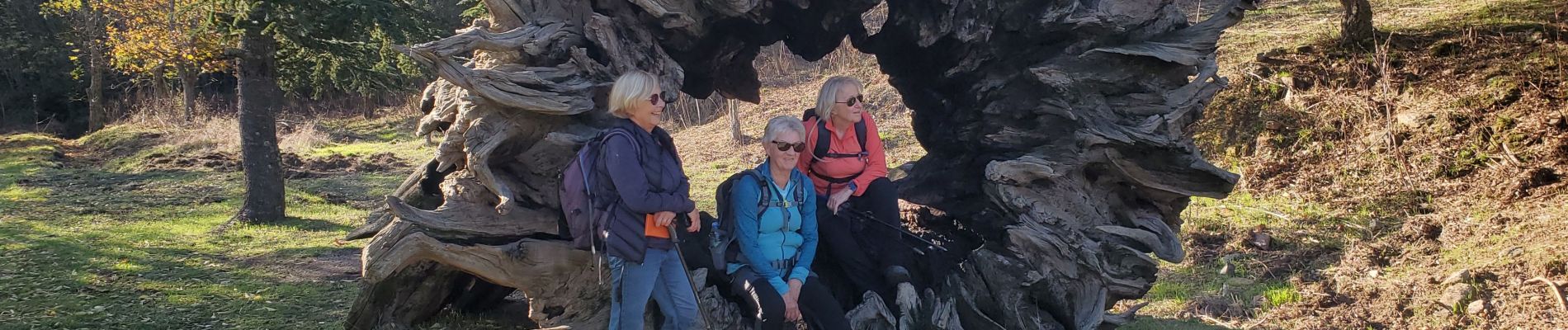
Trail Walking of 22 km to be discovered at Provence-Alpes-Côte d'Azur, Var, Collobrières. This trail is proposed by le boss.
Photos

Positioning
Country:
France
Region :
Provence-Alpes-Côte d'Azur
Department/Province :
Var
Municipality :
Collobrières
Location:
Unknown
Start:(Dec)
Start:(UTM)
285315 ; 4790627 (32T) N.
Comments