Trail Walking Savournon - Défilé des Eysserennes - Photo
 rigol05
rigol05

User

© OpenStreetMap contributors
Length
Length
11.8 km
Max alt
Max alt
823 m
Uphill gradient
Uphill gradient
295 m
Km-Effort
Km-Effort  
15.8 km
Min alt
Min alt
719 m
Downhill gradient
Downhill gradient
299 m
Boucle
Boucle
Yes
Creation date :
2021-11-20 11:34:22.945
Updated on :
2021-11-21 09:52:52.146

(0 Reviews)

Walking
Walking
3h31
Difficulty : Medium

Scan this QR Code to open this trail in the SityTrail application

FREE GPS app for hiking

Logo SityTrail SityTrail

IGN / Geographical institutes

Download SityTrail from the App Store Download SityTrail from Google Play

Logo SityTrail SityTrail Plus

The world is yours!

Download SityTrail from the App Store Download SityTrail from Google Play Download SityTrail on Huawei AppGallery

About

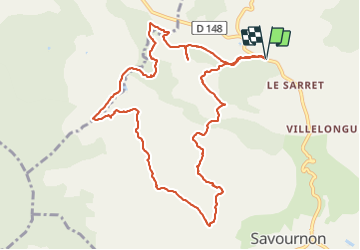
Trail Walking of 11.8 km to be discovered at Provence-Alpes-Côte d'Azur, Hautes-Alpes, Savournon. This trail is proposed by rigol05.

Description

Sortie du 20-11-2021
Itinéraire intéressant et varié en partie hors balisage. Le terrain est par endroit gras et glissant. Pour l'orientation une trace gpx s'avère très utile vers le deuxième km et le neuvième pour le passage dans les marnes après le centre équestre. Le choix du départ est volontaire, une solution plus simple est possible avec un départ à partir du Sarret.

Elevation profile

Positioning

Country:
France
Region :
Provence-Alpes-Côte d'Azur
Department/Province :
Hautes-Alpes
Municipality :
Savournon
Location:
Unknown
Start:(UTM)
721770 ; 4924957 (31T) N.


Close
My subscriptions