


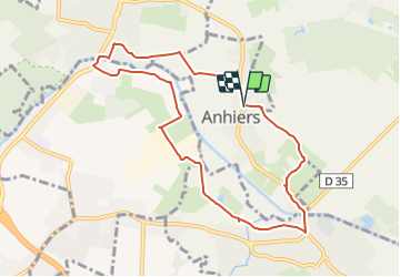
Les 2 ponts Anhiers Râches Lallaing

BrassensJC
User

Length
8.4 km

Max alt
23 m

Uphill gradient
25 m
Km-Effort
8.7 km

Min alt
15 m

Downhill gradient
25 m
Boucle
Yes
Creation date :
2021-11-23 11:29:25.793
Updated on :
2021-11-23 11:30:24.027
1h58
Difficulty : Medium

FREE GPS app for hiking
 SityTrail
IGN / Geographical institutes
SityTrail Plus
The world is yours!
About
Trail Walking of 8.4 km to be discovered at Hauts-de-France, Nord, Anhiers. This trail is proposed by BrassensJC.
Positioning
Country:
France
Region :
Hauts-de-France
Department/Province :
Nord
Municipality :
Anhiers
Location:
Unknown
Start:(Dec)
Start:(UTM)
511067 ; 5583751 (31U) N.
Comments