


vinsobres

losjo
User
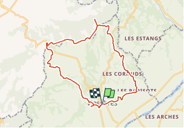

Length
19.3 km

Max alt
490 m

Uphill gradient
460 m
Km-Effort
25 km

Min alt
266 m

Downhill gradient
461 m
Boucle
Yes
Creation date :
2021-11-23 07:50:36.286
Updated on :
2021-11-23 14:35:09.53
6h43
Difficulty : Medium

FREE GPS app for hiking
 SityTrail
IGN / Geographical institutes
SityTrail Plus
The world is yours!
About
Trail Walking of 19.3 km to be discovered at Auvergne-Rhône-Alpes, Drôme, Vinsobres. This trail is proposed by losjo.
Description
rando
Positioning
Country:
France
Region :
Auvergne-Rhône-Alpes
Department/Province :
Drôme
Municipality :
Vinsobres
Location:
Unknown
Start:(Dec)
Start:(UTM)
664335 ; 4910937 (31T) N.
Comments